If you're looking to Download Minnesota Fishing on your Macbook laptop Then read the following guideline.
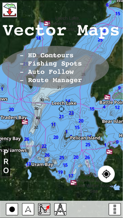
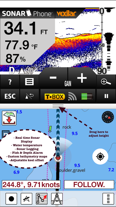
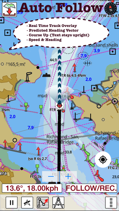
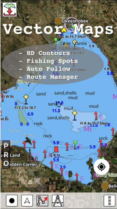
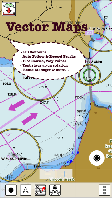
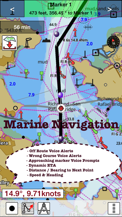
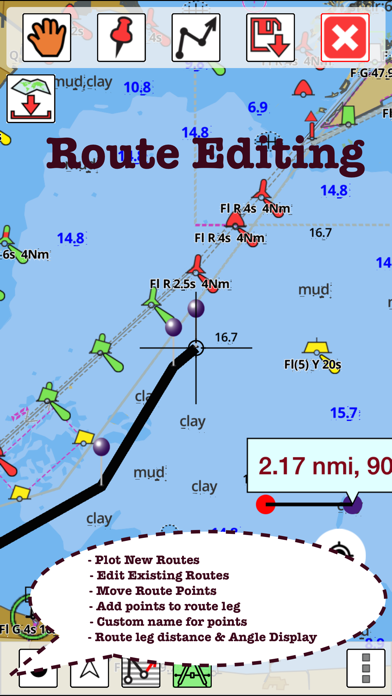
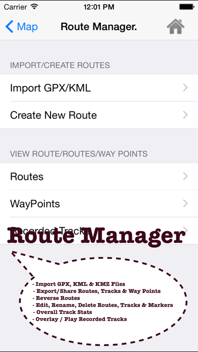
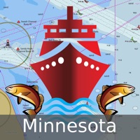
This App offers access to Fishing Lake Depth Maps & Marine Charts for Minnesota. Coverage includes NOAA marine vector charts,freshwater lake maps,USACE inland river maps (HD/1ft/3ft bathymetry. First marine GPS app to have route assistance with Voice Prompts for marine navigation. You can create new boating routes or import existing GPX/KML routes. It supports Nautical Charts course up orientation. Includes Tide & Currents prediction. ►FEATURES √ Beautiful & detailed Hardware/GPU accelerated vector charts (text stays upright on rotation) √ Long press to query the details of Marine object (Buoy,Lights,Obstruction etc). √ Customizable depth(Ft/Fathom/Meter) & distance units(km/mi/NM) √ Customizable Shallow Depth. √ Record tracks,Autofollow with real-time track overlay & predicted path vector. √ Voice Prompts for marine navigation (requires GPS ) √ 1ft / 3ft depth contour maps for anglers for selected lake maps. √ Supports GPX/KML for boating route editing/import. √ Tide & Currents prediction. √ Seamless chart quilting of marine charts √ Enter or import Waypoints. ► MAPS It includes unlimited updates for 1 year. √ Minnesota Lake Maps & Nautical Charts ►ROUTE MANAGEMENT / TRIP PLANNING √ Create New Route/Edit Existing Routes √ Move Points √ Add points to an existing route leg √ Delete / Rename points √ Import GPX,KML & KMZ files √ Plot/Edit Routes √ Enter Waypoints √ Share/Export Routes,Tracks&Markers √ Reverse Routes ►GPS FEATURES √ Auto Follow * Real Time Track Overlay * Predicted Path Vector * Course Up(Text stays upright) * Speed & Heading √ Route Assistance With Voice Prompts * Prompts when approaching a boating route marker * Continous distance & ETA updates * Alerts when sailing/boating off route * Alerts when boating in wrong direction √ Record Tracks ►TIDE & CURRENTS * For US, Canada, UK, Germany & New Zealand * High/Low Tides * Tidal Current Prediction * Active Current Stations ► SHARING * Share tracks/routes/markers on Facebook & Twitter * Export tracks/routes/markers as compressed GPX files. Sample Charts √ Mille Lacs, Leech , Winnibigoshish, Vermilion, Kabetogama, Namakan, Pepin, Cass, √ Minnetonka, √ Otter Tail, Pelican, Big Stone, Traverse, Gull, Bowstring, Sand Point, Trout, Swan, √ Pelican, √ Burntside, Dead, Minnewaska, Whitefish, Cotton, Birch, Osakis, Thief, Bemidji, Island Lake Rsvr, √ North Long, Minnetonka, Rainy, West Battle, Pokegama (Wendigo), Miltona, North Lida, Green, √ Rush, Snowbank, Ten Mile, Big Pine, Whiteface Reservoir, Brule, Pike Bay, Star, √ Sand, Deer, Ida, √Pelican, Ball Club, Height of Land, Pelican, Reno, Cormorant, Lac Qui Parle , Pelican, √ Boy, Island, White Iron, Shetek, Boulder, Crane, Shell, Detroit, Waconia, PLEASE NOTE: Continued use of GPS running in the background can dramatically decrease battery life.